
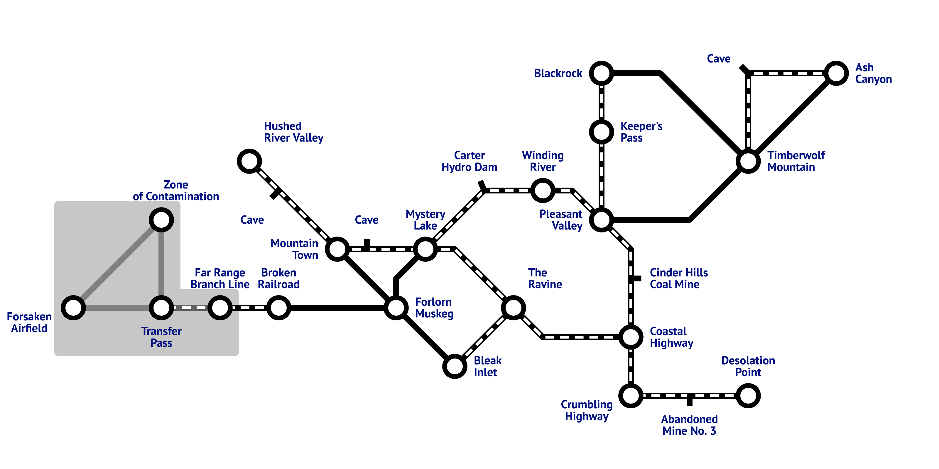
Got tired of having to look up which regions connect to where. Made a simple map based on subway maps…
The Map
All credit goes to pyrotechnology !
- Circles = Regions.
- Little Lines With Names = Interior transition areas.
- Solid Connecting Lines = Directly connected.
- Dashed Connecting Lines = Connected via a transition area.
Click to enlarge…


Cool!
But TM-B transition is a cave, FM-BI too.